System Overview

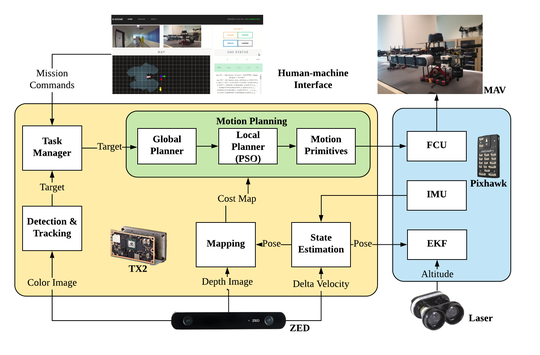
We present a comprehensive design and implementation for a micro aerial vehicle (MAV) that is able to perform 3D autonomous navigation and obstacle avoidance in cluttered and realistic unknown environments without the aid of GPS and other external sensors or markers.
VIO (Backend, Graph Optimization Based)

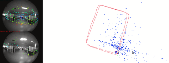
Basalt Backend Walkthrough Overview & Class Names The backend of the VIO framework is contained with the base class VioEstimatorBase (defined in vio_estimator.h) which is the parent class of two type of the estimator possible:

VIO (Frontend, Graph Optimization Based)

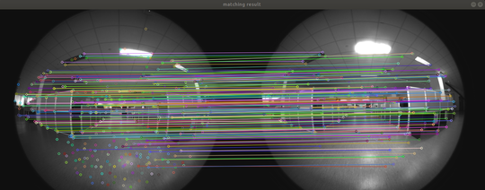
Front End The front end include two types of optical flow: frame to frame optical flow and patch optical frame. Initialization The front end is initialized in basalt::OpticalFlowFactory::getOpticalFlow(vio_config, calib) func param: vio_config: parameters in config.

VIO - Loosely Coupled

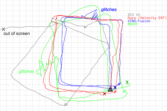
Visual-Inertial Odometry System Overview The ekf_sensor_fusion package performs loose-coupled sensor fusion from stereo camera’s visual odometry and IMU’s inertial measurement to produce UAV pose estimation. The filter is formulated to take in body-frame velocity measurement from the visual odometry module (ZED camera), instead of the pose measurement with respect to the initial body-frame.

Mapping

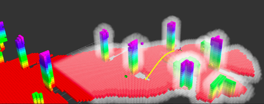
A 3D reconstruction system for MAVs using GPU is implemented in our work. We present a highly efficient approach to update the euclidean distance filed (EDF) on a 3D occupancy grid map. The occupancy map is updated with the voxel projection method and EDF is accelerated with dimensionality-reduction Voronoi diagram.

Motion Planning

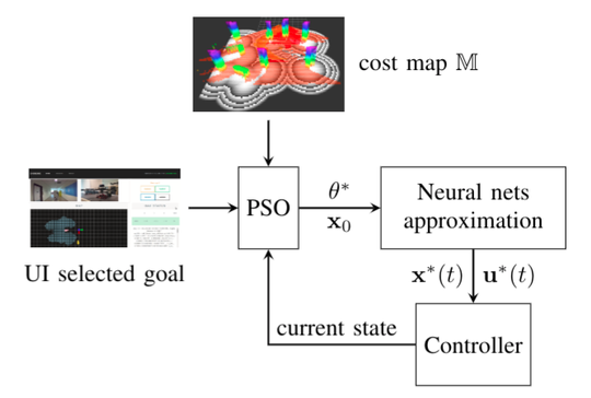
To concatenate with the state estimation and mapping modules, a 3D motion planning module is designed for real-time path and trajectory generation, where a collision-free and dynamically feasible reference trajectory is generated to guide vehicles maneuver safely towards its desired target.

Web-Based User Interface for UAV

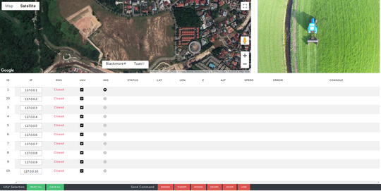
This was a web-based UI (as shown in the image), I developed with the purpose of connecting to multiple drones via their IP address and reporting back the status of each drone, e.g. position, video feed and health status. The user may send commands (takeoff, mission, swarm, hover, landing) to any connected drone directly from the UI. Google map was inserted to show real time locations and trajectories.

Unity Simulator

The simulator is introduced in this post. Without the presence of the real vehicle and further ado, algorithm developers can swiftly test, debug and revise their codes in the provided mock-up UAV in the simulated environment which is modelled comparable to the actual test field.

Snapdragon

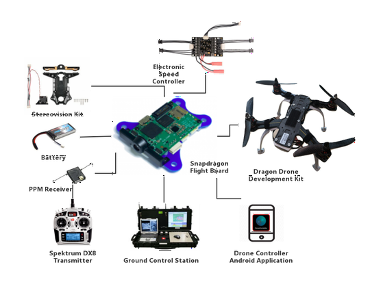
We provide step to step guide here about building a drone with snapdragon platform. We present an organized documentation that presents in detail, the platform structure as a whole, from hardware to software architecture, including installation and API related applications. Although there are numerous potential applications, getting to understand the structure of the flight platform can be cumbersome and confusing.